 When Google Street View first hit the market, one suspects that many people used it for rather mundane things. You would have a look around your own neighbourhood or titter at some of the compendium of funny situations randomly snapped by the Street View car.
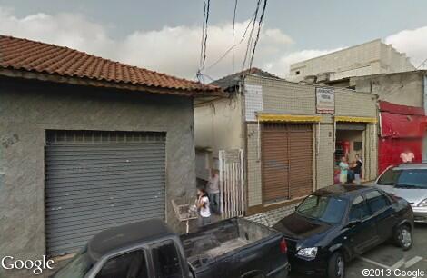
Some researchers from MIT want to put things to slightly more enlightening uses however by tapping into the images displayed on your average Google Map to gauge the emotional response people have to their environment.
The tool they’ve created has a simple premise. Online users are presented with a pair of images randomly drawn from Google Maps. The users then select the image that best defines a quality for them. An algorithm then uses this analysis to assign a neighbourhood a score from 1 to 10 for each quality.
These qualities typically involved things like how safe an area looked or how unique it was. Interestingly, the researchers found that there were more disparities between neighbourhoods in New York and Boston than there were in Linz and Salzburg, in Austria.
They also found that, controlled for income, area, and population, the perceived-safety scores for neighborhoods in New York correlated very well with incidence of violent crime.
Researcher Cesar Hidalgo suggests an interesting element of the study is in how our perceptions of an area translate to hard statistics for that same area. Do our perceptions map to specific data on income for instance?
“Income inequality is invisible if it’s in a bank account, but if it’s expressed in assets, as homes and cars, it becomes experiential,” Hidalgo says. “And the question for me is whether the experiences of inequality can elicit behaviors. I don’t have any evidence that this is the case, but at least I can show that some cities provide a more unequal experience. I can at least hypothesize that this might be something that explains social tension or social stress.”
While the initial study asked volunteers to rank neighborhoods in four cities according to three attributes, Hidalgo’s Macro Connections group has launched a website that will expand their data set, ranking neighbourhoods in 56 more cities according to a revised set of five measures: how safe, wealthy, lively, depressing and boring they seem.
The plan is for this data to eventually help guide policy making decisions.
“One of the things that would be the most interesting in the long run is to overlay these maps with expenditures of government, narrowly defined by the things that affect how places look, such as repaving roads, building parks, or putting cables underground,” Hidalgo says.
That actually looks kinda cool. Wonder how many people need to use it for it to become useful?
I suspect as many as possible is the best answer. Will certainly be interesting to see what findings emerge from this.